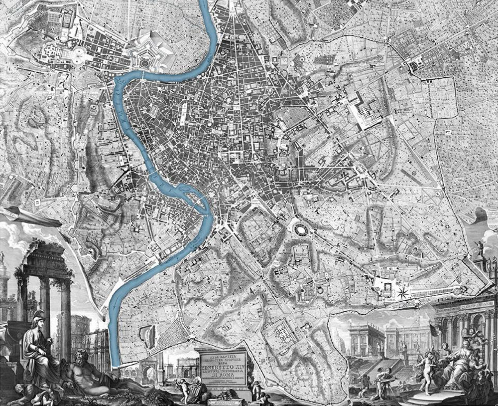
The 1748 plan of Rome by G.B. Nolli is the most important map of Rome ever made. It was the first accurate map since antiquity and has far more detail in it than any other map of the city, including modern computer maps. Most of the city maps between 1748 and 1870 either simply trace the Nolli map or use it as a base. Little updating was needed in this period because Rome was in a period of stasis until it became the capital of unified Italy in 1870. The influence of the Nolli map persisted well into the 20th century. The city government used it as the base for the official map of Rome within the ancient city walls until the 1970s. ¶ The map is composed of 12 plates, each measuring approximately 80 cm by 54 cm with the assembled map measuring 176 cm by 208 cm. White on the map represents not only the public urban space of streets and squares, but also the semi-public space of courtyards and gardens within major palaces, as well as the interiors of churches and theaters. Entryways, colonnades and major stairways of palaces are shown in detail as are the plans of all the churches in the city. Vegetation in the numerous villas is illustrated with symbols so clearly that it is possible to identify different types of trees and shrubs. ¶ I first came across this remarkable image when I came to Rome in 1960. Dissatisfied with the available commercial maps of the city, research soon revealed this as the best tool for studying the city in which I had come to live and work. In spite of studying and working on it for over half a century, to this day I keep finding information in it that I had not come across before. It became the key map for the course on the history of Rome’s urban development that I have been teaching for Penn State’s Rome program since 1996. Other US university programs regularly ask me to give talks on maps of the city, and the Nolli map is invariably the protagonist. In 2003 my studio (Studium Urbis) sponsored the first international conference on Nolli and his influence: Giambattista Nolli: Imago Urbis and Rome.
Images & text are copyright © by their respective owners.
Information about the imgtlk project.